Took the initiative to add this as an idea so that it could be voted on. You
can find that here: https://devsupport.flightsimulator.com/t/3299
Water polys are a pain but it an be done but it depends on what you want to
do. Polygons can’t have holes/islands so if you do this you’ll get a pretty
bad result. For coastlines it works as you can do a one-sided buffer of the
polygon out towards the sea and then you’ll get a smooth transition. For
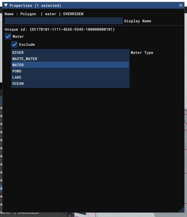
reference, watertypes are… 0 = river 1= wastewater 2= water 3=pond 4=lake 5=
ocean For some reason 3 and 4 do bugger all except give a subtle difference at
the edge of the polygons I.e soft or hard transition from shore to the deeper
water. I have found that ocean doesn’t exclude water where say rivers are so
you need to them use an exclude value of 2 for say a river polygon then
duplicate the polygon and set water type 1 and then you will be able to adjust
the buffer of the polygons and Falloff to get the desired effect. I hope this
makes sense, I have my workflow on my pc and I’m not at it right now to give
more detail but happy to offer any help as I’ve been at this for many many
months now, playing with all sorts of combinations of land and water scenery.
However, I still believe this component of scenery design is flaky and that M$
and Asobo are putting way more attention towards airports and aircraft
improvements. You could also set a higher value for the layer field in the
shapefile as this will set the priority of any overlapping layers. Like
vegetation, if the layers overlap and they both have the same value then it’s
anyone’s guess which layer will will win so I usually set a priority to my
polygons as a matter of course, that way it also helps prevent potential
issues with 3rd party sceneries. Without good docs it’s still anyone’s guess
as to how the whole scenery system hangs together as well as its limitations.
There’s a tool over on fsdeveloper.com called bgldec
as it can decompile cgls for msfs now. Sorry I don’t have the link but
shouldn’t be hard to find.
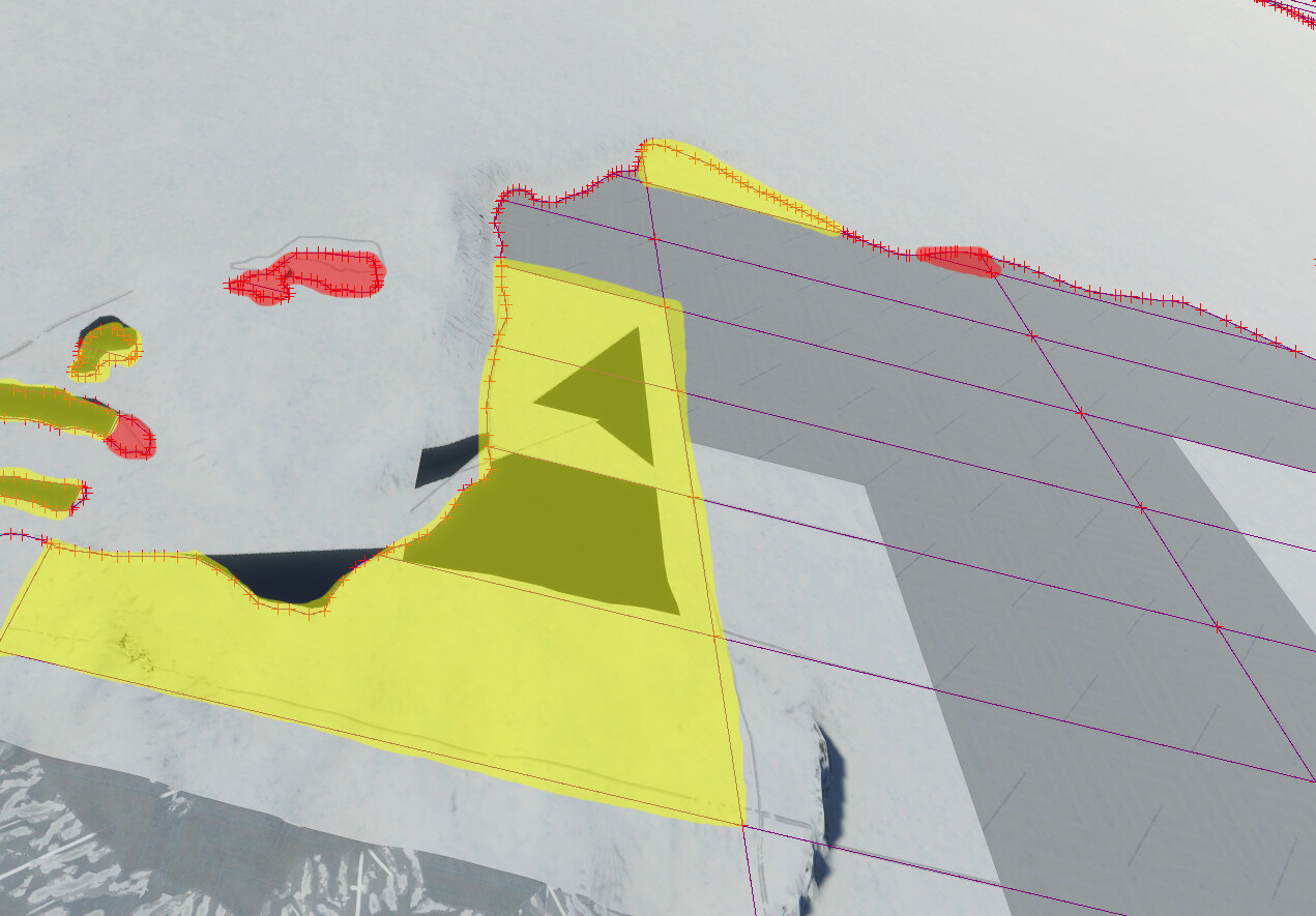
Still trying to shed some light on this topic and wrecking my brain trying to
make sense of it: I’m trying to create a clean slate for a coastal area
excluding ALL water polygons. From what I understand from
/comments/525/view.html this is still not possible
and exclusions are only possible INSIDE the existing water polygons.
Correct? The water polygons used in my area of interest seem to be from
Openstreetmap (OSM). So this is not perfect and comes with the risk that the
excludes won’t match anymore once anything happens that causes MSFS to update
the water polygons in the area. Of course this rules out the option of drawing
the exclude polygons by hand inside MSFS but requires some in-depth work with
GIS tools. For a starter working with OSM polys seems to work “good enough”
though. I’m tiling the polygons before exporting them to QMID15 to minimize
the risk of incomplete polygons and artifacts. Still there are some polygons
that cause artifacts. Loading the SHP in Scenery Editor shows some issues that
are not documented anywhere: While most polygons are shown file, there’s a
number of polygons that are either tagged as “OVERRIDE” or “OVERRIDEN”:
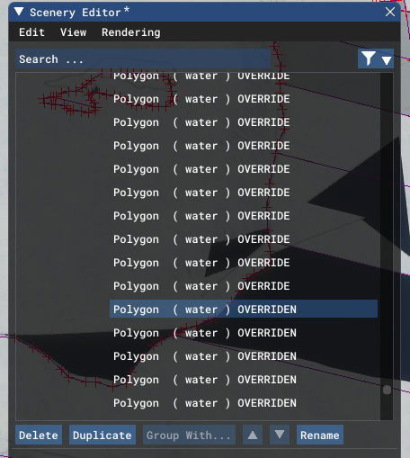
polygons are as follows: Trying
to make sense of which polygons are tagged as what doesn’t help much neither:
YELLOW: OVERRIDEN RED: OVERRIDE
ALL OTHERS: No Tag Questions: 1. What do the tags “OVERRIDEN” and
“OVERRIDE” mean? What needs to be done to make the polygons valid? 2. Where
can I find the waterbody sources of MSFS? TMFViewer from the previous MS FSX
SDK can still open the waterbody BGLs created by the MSFS SDK. I have been
unable however to locate the MSFS default waterbody BGLs (provided they are
saved as BGLs?)
UPDATE… weirdly enough I have been able to solve the issue above by manually
drawing the exclude polygons inside MSFS and saving them as shapefiles there
(one for lakes, one for ocean water). In that case the exclude polygon doesn’t
need to match the existing water polygons and can overlap the default
polygon’s boundaries. It seems that MSFS uses some kind of proprietary format
for shapefiles as compiled shapefiles created inside MSFS behave very
different to those with the same attributes and XML definitions created in
QGIS, Global Mapper and the like (tried both and on both cases the results
inside MSFS look similar as above). Best case scenario though would be that
it’s not proprietary and someone could just give us a push into the right
direction. Meaning a hint what’s required to import existing watermask
polygons (or polygons in general) into MSFS. Since Asobo imported OSM polygons
into MSFS there must be a way to bring in polygon content from outside into
MSFS without having to struggle with messed up imports.
I’ve given up on polygons for
this, but it has been possible to use a texture with an alpha channel floating
on top of the surface as some other developers have already done. I had to
make it a simobject to show up, as a normal object it wouldn’t outside of
development mode for some reason. However it has to be a very silly height
above the surface - 10 to 20 metres and sometimes more - to prevent it from
flickering from a distance. Since this one is so huge - about 20 km across -
20 km of flickering isn’t a great look. I presume this is some sort of alpha
channel issue. Does anyone have any idea how to stop it or are we stuck with
it? Not much point in taking it any further unless I can cure the flickering.
Last year I created a tool that produces MSFS terrain shapefiles from standard
vector sources: https://msfs.nool.ee/tools/watermask/ Custom landscape
tutorial shows how it’s used: <https://msfs.nool.ee/tutorials/custom-
landscape/> MSFS uses non-standard shapefiles and you can’t directly export
data from GIS software to MSFS, it has to go through a specialized tool.
Does this means that we won’t ever be able to officially buy Sat Data, Landuse
and Water Masks to use with our projects with an official tool? Or that it
will happen, just not “shortly”?
I personally used and loved MSFS Toolkit but I think you’d agree that an
official supported way of adding/editing/removing/prioritizing local CGL data
is something that I’d rather see coming. What I’m curious about is whether
it’s planned or just never gonna happen
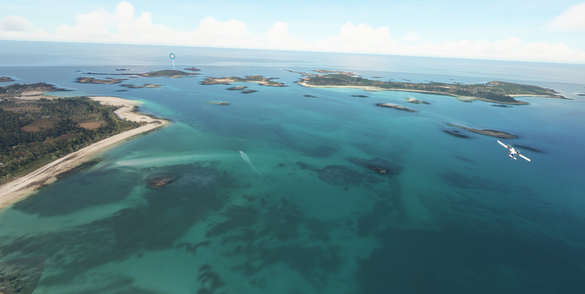
Quite simply, we need a transparent ocean, and a transparent lake polygon. The
edges of the ocean poly are semi-transparent, so this tells me it is possible.