Version: 1.0.77.0
Frequency: Consistently
Severity: Blocker
Marketplace package name:
Aerosoft Antarctica Rothera (with CGL - heightmaps working)
Aerosoft Antarctica Casey (without CGL - heightmaps NOT working)
Bug description:
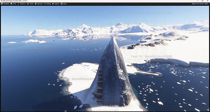
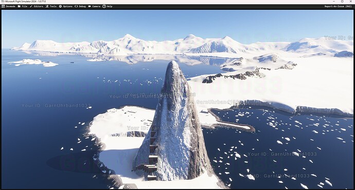
Took me a while to figure out why heightmaps were displayed at full resolution in some packages while in others heightmaps were obviously bound to the max DEM resolution at the location.
Eventually figured out that heightmaps are ONLY displayed at full resolution (no matter if they have the “precision=TRUE” tag in the XML or not - so if they’re new or old style heightmaps) if the following criteria are met:
- A secondary aerial CGL in the same package
- CGL needs to be within a certain maximum distance from the heightmap (50km seems to work, 800km not)
- CGL needs to cover at least 1000x1000 meters.
Without CGL in package:
With CGL in package:
Problems that arise from this:
Provided that the limit of maximum=1 CGL per package remains, heightmaps can no longer cover larger areas, remote airstrips in the same package or POIs further away from the package center. It is my understanding that this has many bad implications on both 3rd party and world update content and obviously is a bug.
Further tests indicate that this limitation indeed still remains (Builder hangs upon adding more than one CGL asset to the package).

