Hi, I have found that adding a water polygon of the same type to the
underlying area excludes the water.
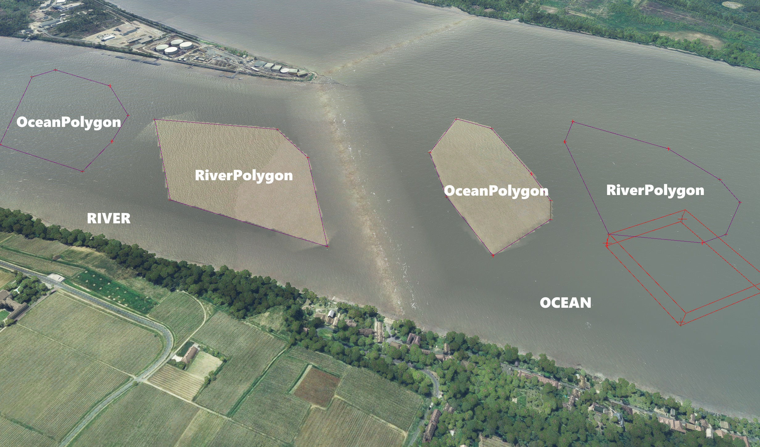
Why is this a problem? Many
of the World Updates add water exclusion polygons around areas like this
(shown by the blue border).
We
can remove the TIN easily, but the water exclusion remains. This means we need
to use a water polygon to re-introduce the water, ideally of the same type as
the surrounding area. So in reality there are three layers.
- Bottom: Original River Water
- Middle: WU River Exclusion Polygon
- Top: Our River Water
As far as I know, we can’t exclude an exclusion so we need to add a new river
water polygon on top. The bug stops us from overriding the water exclusion
with the same type. We have to place a different water type (e.g. Lake or
Ocean), which does not blend as well with the rest of the area. From what I
can see there is no beneficial reason to have two water polygons of the same
type cancel each other out. Is this something that can be fixed? Kind regards,
SFSimsDev
Can you give a latitude and longitude of the above example?
You can replicate the effect anywhere by checking the tile type and then
placing a water polygon of the same type over it. I just went to a random
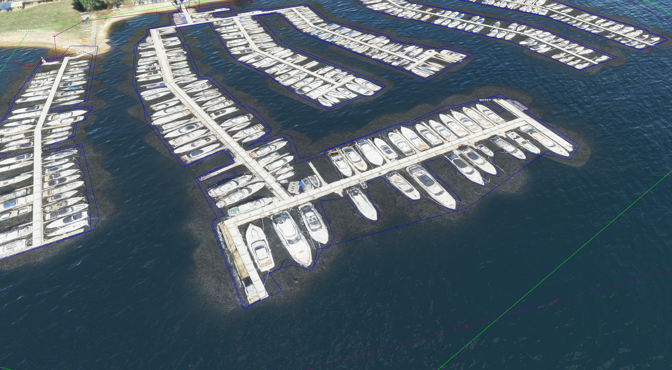
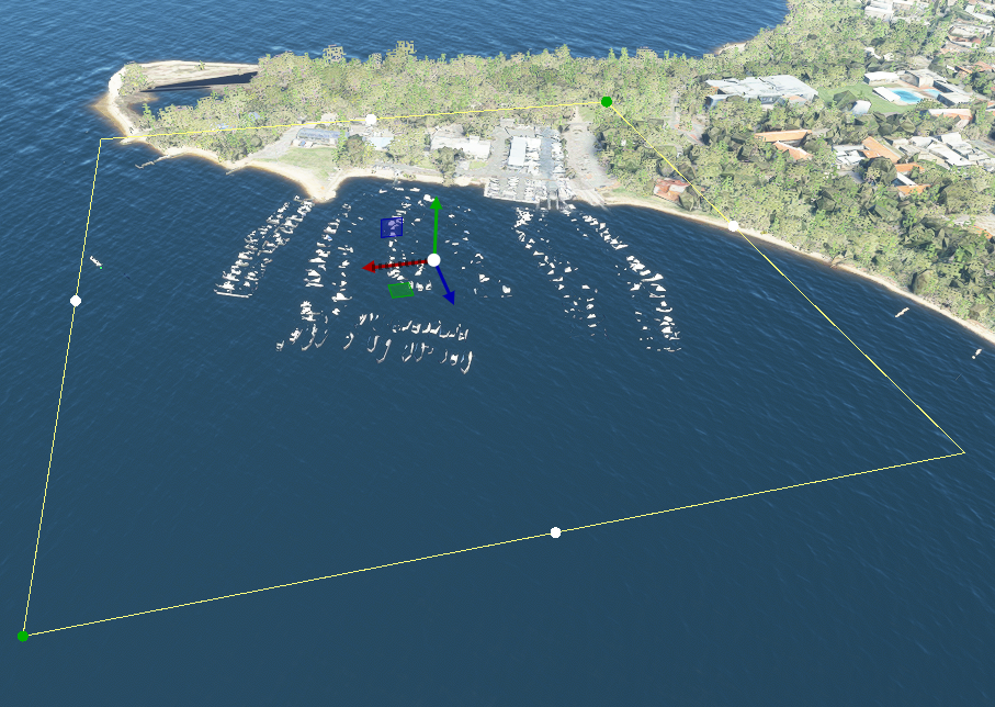
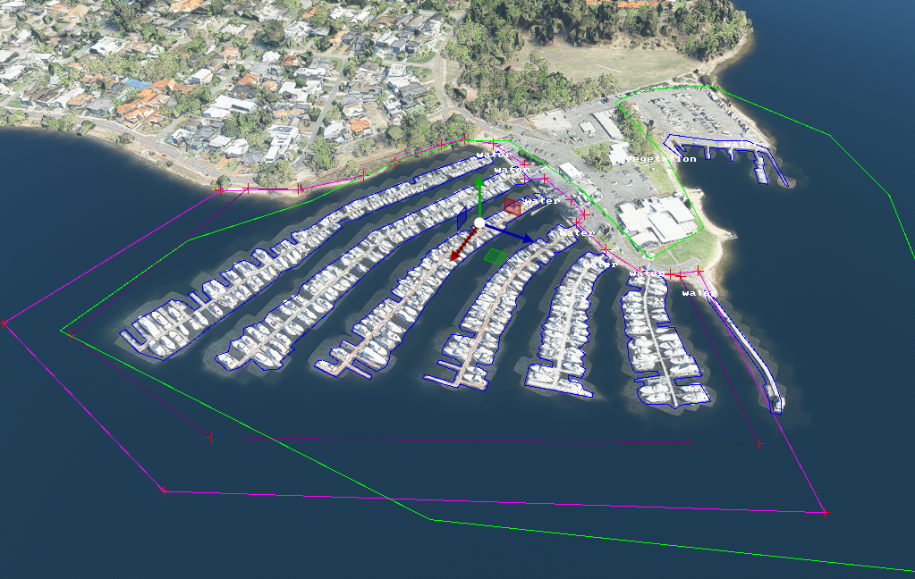
estuary area for the first image. That said, the second picture is of one of
the many marinas in Perth, AU with the Aussie world update installed.
Doesn’t the exclusionrectangle with excludePolygons get rid of those polygons
(water exclusion)?
I also see the problem with using water excludes. You can’t just lay a big
water|river over the area. But You can lay a water|water over the area, and
cover the river. A poly with noTIN, and another poly with water|water will
cover up the river. But there may be anomalies… Using the priority system
for water types would solve the problem if it was implemented.
Yeah that’s right. In the scene we have a noTIN poly, then another Water
(Lake/Ocean) ,over the river but it isn’t perfect. Ideally it’d be a noTIN
poly, then River over the original River.
Hello @SFSimsDev As @mamudesign suggested, an ExclusionRectangle with the
excludePolygons option checked should remove those. However, it might
require to save and reload the scenery project to see the effect.
Regards, Sylvain
Ok I’ll give that a whirl. Thanks both.
I’m not sure an exclusion rectangle is what’s wanted here. The problem is
excluding the TIN of the docks, and then getting the area covered with water.
2 polygons does this. One excludes the TIN. the other just covers the area
with water of type Water. That overlays the existing river, and when in the
Community folder, the result is pretty good and blends in. I’m not sure what
the purpose of a water Exclude may be. It causes more problems that it could
solve. If you want water of type River gone to expose the underlying land,
just cover the River with a water type River. If you want to ‘correct’ the
type River, then just cover the whole works with type
Water.YEAA.zip
Ok, I’ve found @mamudesign 's solution works seamlessly. So the idea is to use
a regular polygon to exclude the TIN and then another ExclusionRectangle set
to exclude polygons. The latter removes/overrides the water exclusion polygon
that is built into the World Update. As such there is no need for a further
water polygon placed atop the water exclusion polygon (which results in the
‘same water type’ collision that seems to occur as per my original post). This
stops the horrible ocean/lake blending into river problem too as the original
underlying water type (river in this case) is back as it should be. Thanks all
for helping to get to the bottom of this.
This area is covered with water by default. It makes sense to me to remove
previously defined polygons, just like you remove previously defined aprons
when you create a new airport over an existing one. Regards, Sylvain
In my case, there are no previous polys. Just the default OSM/CGL water.
Well maybe this is a misunderstanding but in the scenery sample you provided,
when enabling the “Debug shapes” terrain debug option, you can clearly see
water polygons being defined by the microsoft-australia-point-of-interest
package.
Your method works! Very good. 2 ways to skin the cat.