Hi.
I am trying to model an airpark that is not present in the sim right now and trying no to ask too many questions but I couldn’t find a solution to my problems until now.
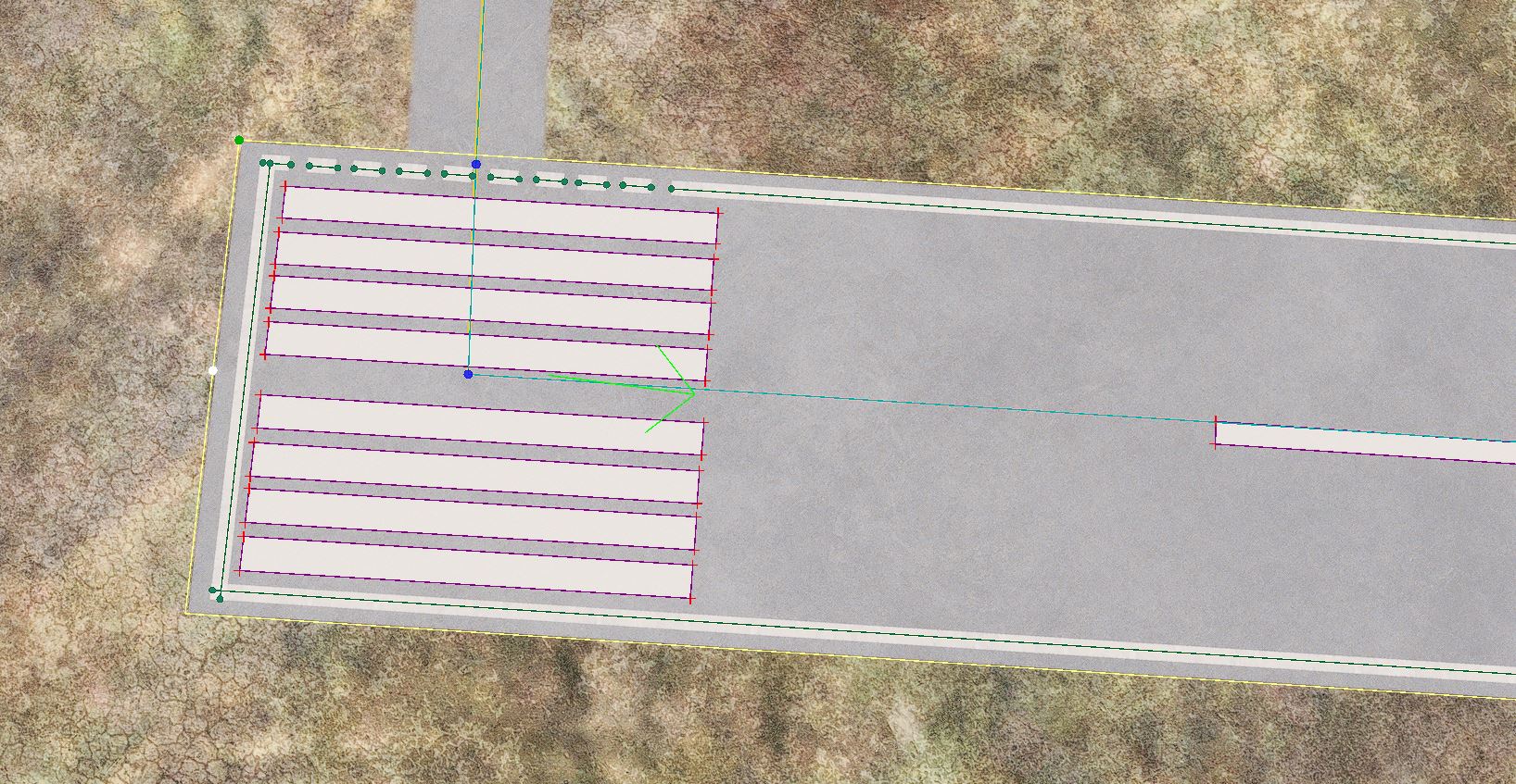
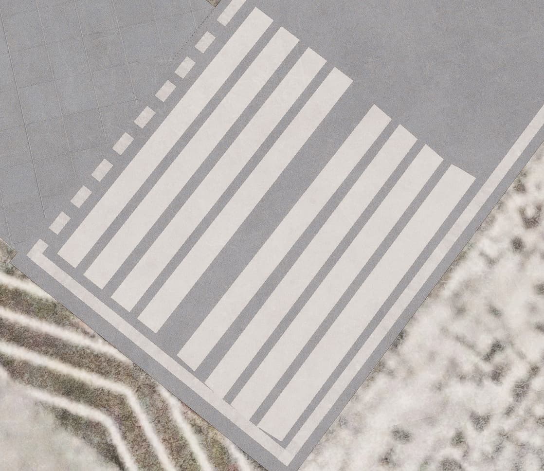
- As I want to design this airpark as closely to the real life as possible, I used polygons to draw threshold markings. While designing in SDK everything looks fine, I save my project, rebuild package, copy the newly built package into the Community folder and when I launch MSFS the shape of markings becomes distorted. A similar problem appears in the center line as well. Please have a look at the screenshots.
In SDK
In sim
Tried to find the reason or the solution from Google but couldn’t. Any ideas?
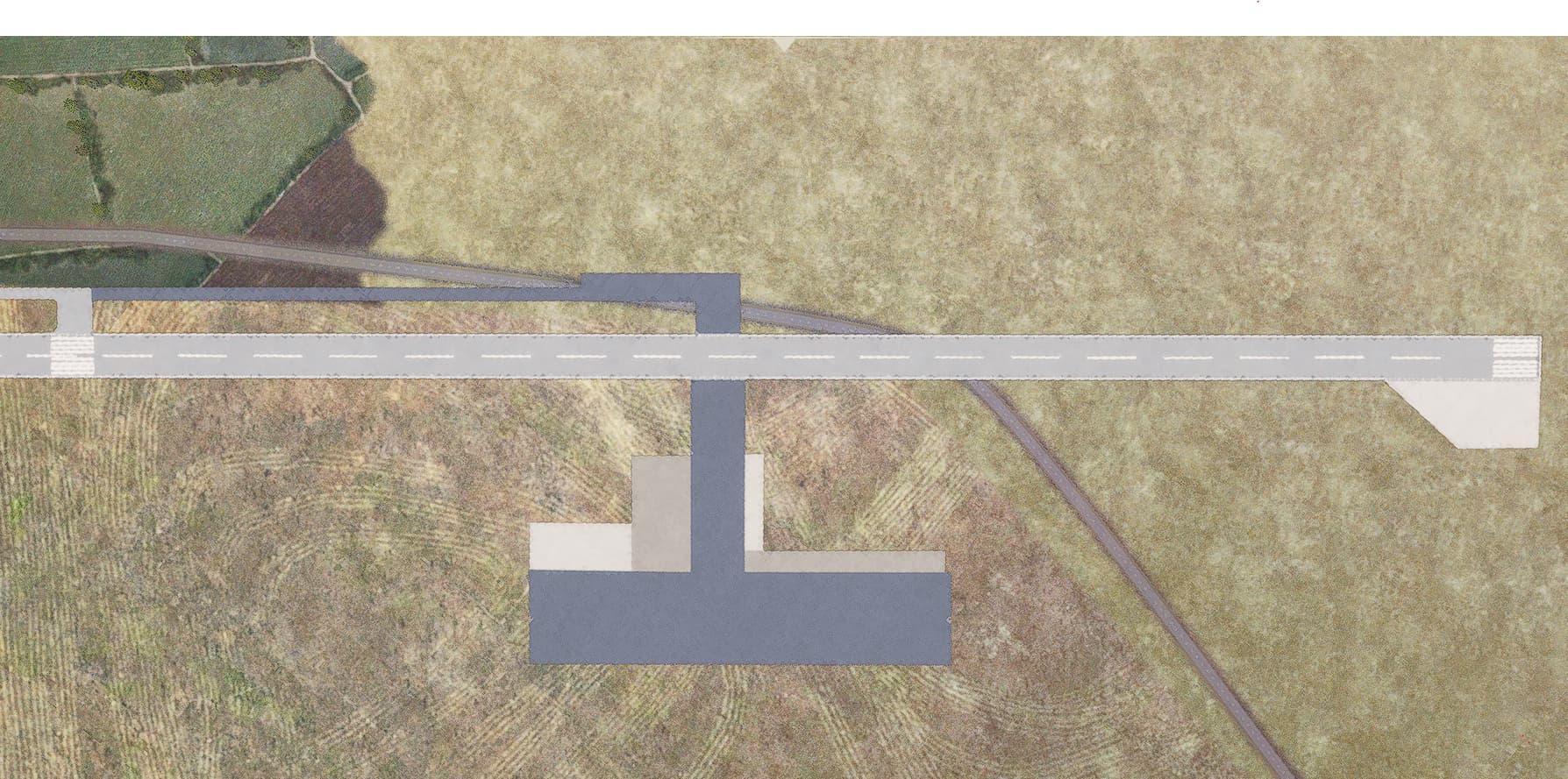
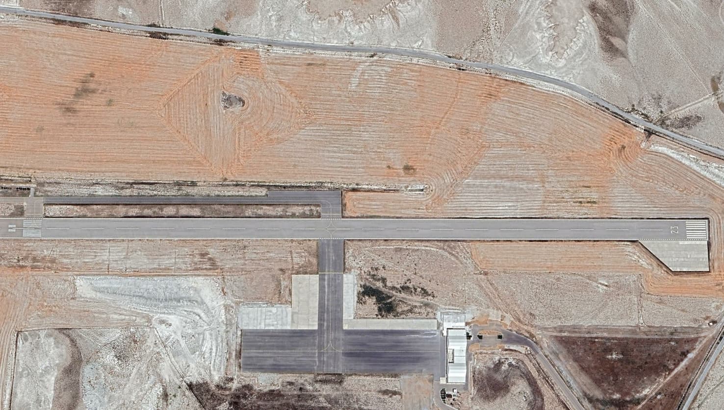
- This airpark is not present at current Bing data used in MSFS and one road is not at the right place. I wanted to change that but I couldn’t delete it no matter how I tried. I used transparent grass and paint textures as suggested at other posts but that didn’t work for me.
Here’s the up to date satellite imagery and the MSFS version:
Is there any other way to get rid of that road?
Thank you very much for your guidance.
Thank you very much for your recommendations @mamuDesign.
-
I was pretty happy when I learned how to use Material Editor with polygons but seeing that crooked lines killed my mood. I will try to use Aprons instead.
-
I do not have default aprons. Bing maps do not show the airfield at all and I am using a third party tool to use Google Maps data and trying to build the airfield where it is supposed to be. In short, when I use the regular sim data, I do not see anything at all, so I didn’t have to use delete commands.
-
I tried to use every option I come across with  Sadly nothing worked yet and I think I will have to surround the airport with some other texture to get rid of it.
And one more thing, do you know any easy and smart way to implement real life elevation data to this region? I visited the airfield several times and there are hills near the runway but MSFS has all the area flat. I shoot photos from those hills every year and I want to design the area realisticly.
Thank you very much for your help. I learn new things with each and every question and that seems a nice thing to do for retirement. Thank you.
Where is this place?
Most likely the default airport has some flattening in place that you can turn off to obtain the hills back
There’s no default airport at the location. Data is pretty old.
Here are the coordinates: N 39°17’59.29’’ E 31°29’38.50’’
In Turkey.
https://shm.aero/