Hello! I tried posting this as a wishlist item on the MSFS forum but the mods
closed it with message that follows, so reposting here as advised. >>Sorry to
close this. Unfortunately, we cannot accept SDK requests in Wishlist anymore.
(The ones >>that are there are grandfathered in.) >>You may want to log a
request at
devsupport.flightsimulator.com. The
SDK team monitors those >>forums. OP follows:
MSFS is a great digital twin of earth, and the current weather system is
getting better all the time. Being able to see the earth under various weather
conditions and seasonal changes (in progress) is important in order to fully
simulate different real world work flying conditions, but It would also be
useful if there was some way to easily change the water height to simulate
flooding and other climate related events.
Unfortunately, using the current polygon method you can’t emulate actual
flooding that progressively covers areas, and has buildings sticking out
depending on the water height. eg:
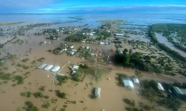 ref: [Queensland floods:
Burketown residents warned of crocodile-infested waters ahead of expected peak
| Queensland | The Guardian](https://www.theguardian.com/australia-
news/2023/mar/12/queensland-floods-burketown-residents-warned-of-crocodile-
infested-waters-ahead-of-expected-peak)
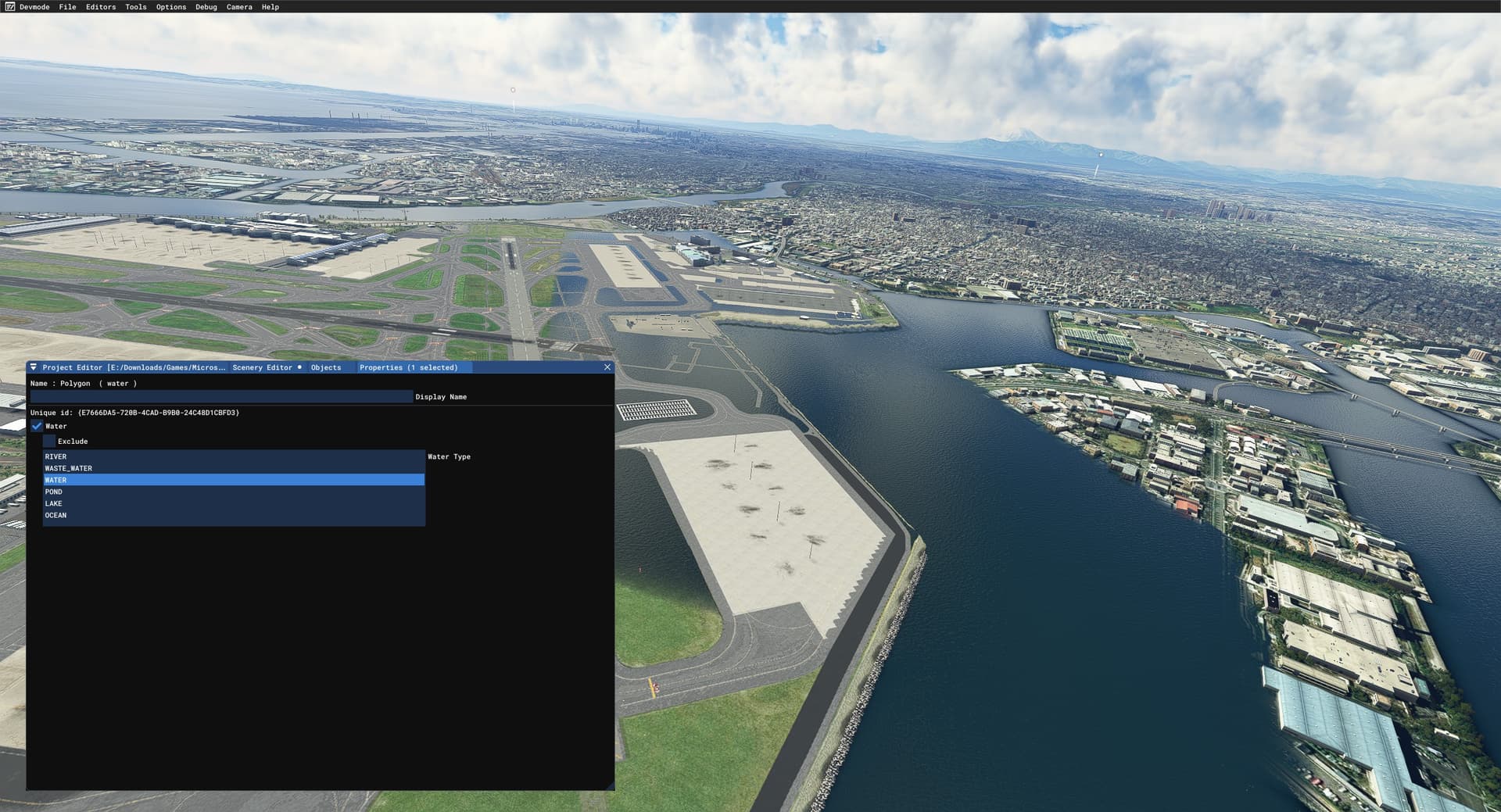
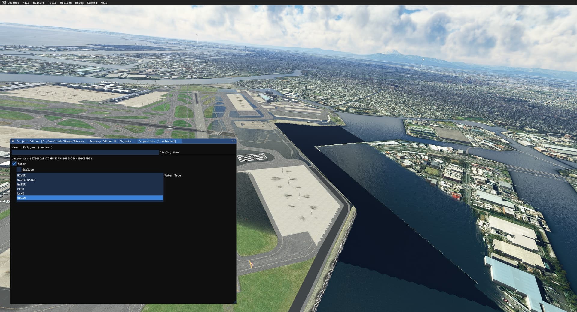
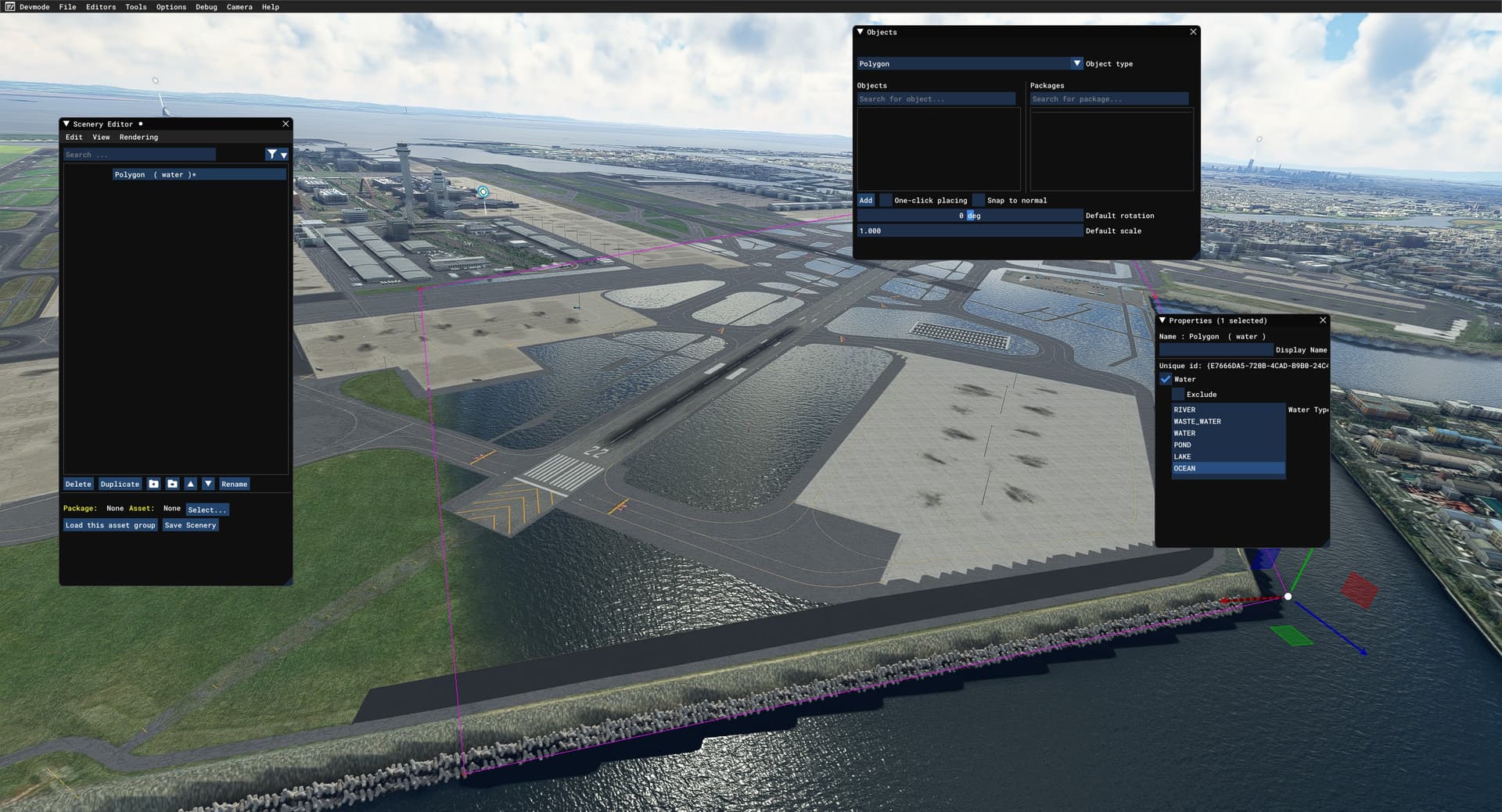
I just did some quick tests, and while you can set up a polygon as a water
layer a number of issues immediately become apparent, some which you can see
here.
 20230312142659_1 1920×1039 243
KB
 20230312142731_1 1920×1039 237
KB
 20230312143901_1 1920×1039 264
KB
 20230312141731_1 1920×1039 238
KB
I suspect there isn’t an easy solution here, given the number of issues you
can see in the screenshot. . Airport land is submerged but runways & other
objects are not affected. . Exclusion when overlaying the same type such as
ocean (known issue in docs), though water will be seemless (different type
from ocean) . Overlayed on the map area on the right it excludes all generated
TIN objects, though I guess custom added ones might show through the water,
but that’s not feasible to do for a large area.
The context here was a quick test to see if I could use MSFS to simulate some
Climate Change effects for a project I have.
Ideally I’d just like a global variable to change the ocean height and have it
done automagically, but that’s not possible afaik. Seems fixed. Some way to
declare a radius where you could raise the water table would be useful, for
localised flooding, and a way to overlap them for different levels would be
most realistic. That way you could create localised flood/emergency scenarios.
So opening up this wishlist item to kickstart something in this area.