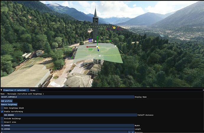
Hello everyone. Since most of times scenery developers have to create models and only after, adapt the terrain to the model itself, it would be awesome, extremely time-saving and abnourmously useful to be able to do the opposite.
Whenever we apply an heightmap to a piece of terrain, the later wraps around the default terrain (picture below)
This generates an enormous amount of data (short piece below) which could be used to export that piece of terrain into a black & white Displacement Map we could use in our 3D CGI program to recreate the actual ingame terrain
XML:
<Rectangle displayName="HEIGHT_CAMPANILE" groupIndex="1" width="73.499985" falloff="500.000000" surface="{47D48287-3ADE-4FC5-8BEC-B6B36901E612}" priority="0" precision="TRUE" latitude="46.16429628849714" longitude="8.32601261387702" altitude="482.65115316305310" latitude2="46.16495747442070" longitude2="8.32601261482440" altitude2="482.65155906789005">        <Heightmap width="64" data="528.354797 528.375000 528.371399 528.375000 528.400757 528.417419 528.445984 528.501770 528.593750 528.659790 528.704651 528.771851 528.856689 528.973022 529.104065 529.165894 529.215210 529.263672 529.328796 529.442017 529.539673 529.580750 529.603455 529.590332 529.544128 529.530396 529.490540 529.446716 529.417969 529.404968 529.370667 529.303284 529.230042 529.178833 529.128662 529.020203 528.897583 528.770081 528.656677 528.559143 528.464783 528.356995 528.216309 528.057312 527.857361 527.606995 527.349548 527.118958 526.919128 526.680176 526.411804 526.136353 525.885559 525.648804 525.432373 525.246094 525.106445 524.943298 524.728516 524.504883 524.246277 523.967651 523.709839 523.464111 528.697327 528.694397 528.695312 528.723633 528.774719 528.775574 528.791016 528.844666 528.923584 528.987610 529.029053 529.058472 529.126892 529.207886 529.279907 529.342285 529.382935 529.412476 529.452209 529.564331 529.675903 529.731262 529.739136 529.712891 529.668396 529.657898 529.625488 529.581116 529.544373 529.531372 529.490234 529.398560 529.344910 529.314575 529.276001 529.186279 529.092346 529.005310 528.925842 528.849854 528.767578 528.675476 528.555725 528.405640 528.223206 ETC ETC ETC </Rectangle>
This would mean being able to work 3D models on the terrain BEFOREHAND instead of having to create models blindly, or meaninglessly flatten out non-flat airports.
We could finally export our heightmap model data into our favourite CG program and wrap models around the default terrain in-game, saving us hours of terraforming clicks and fixes.
Any chance we could get this?
