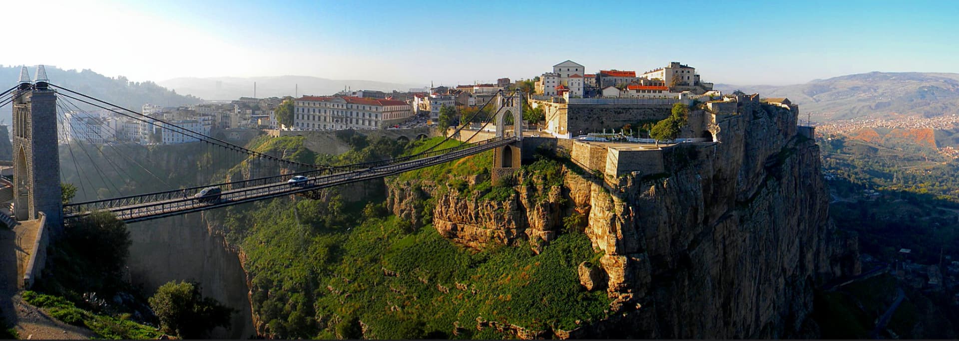
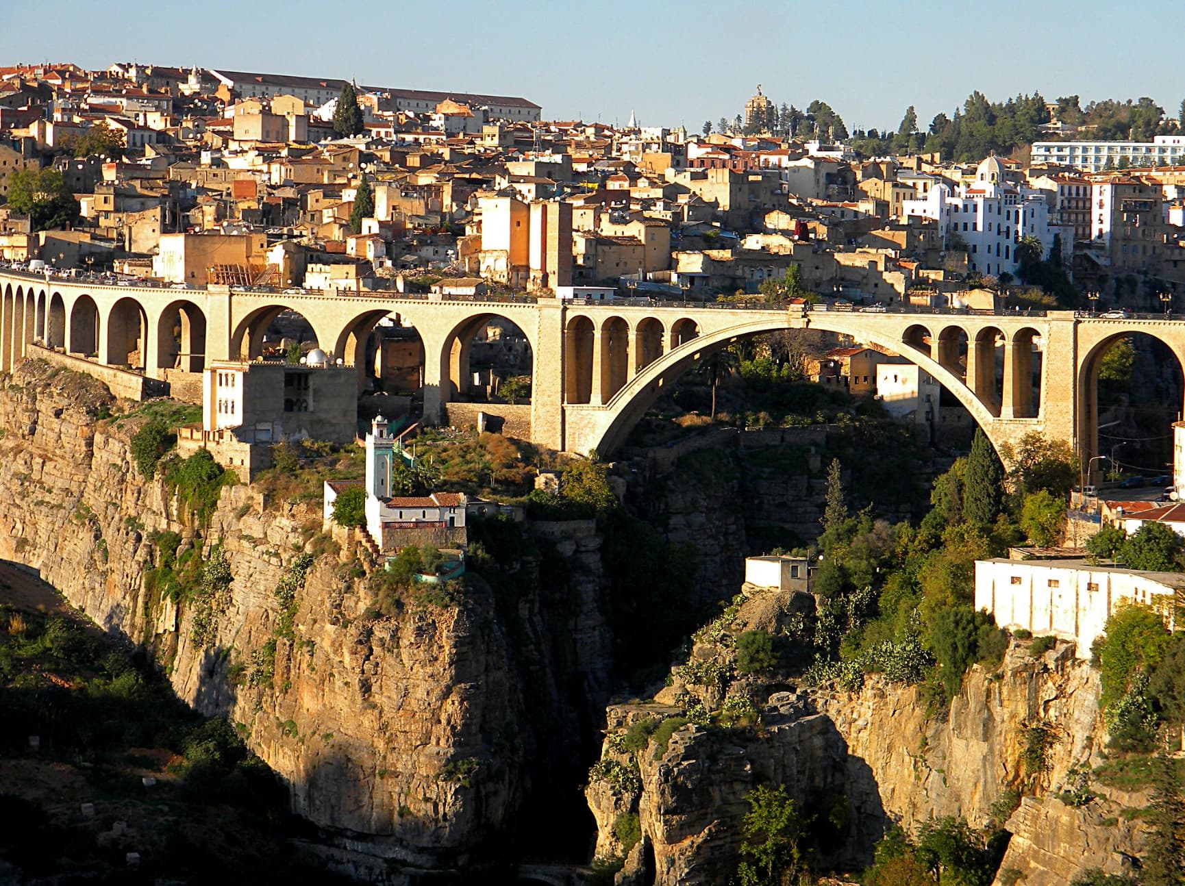
A project I’d like to tackle is the Algerian city of Constantine, the DABC airport I can do but I would also very much like to improve the city scenery, particularly the 200m-deep 2km-long gorge that runs through the middle of the city. The MSFS 2024 livestream mentioned improved DEM in many locations, but can I have hopes for North Africa as well, given the low-quality data that’s available there currently? This is what the gorge looks like:
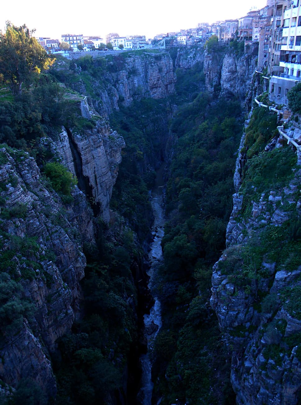
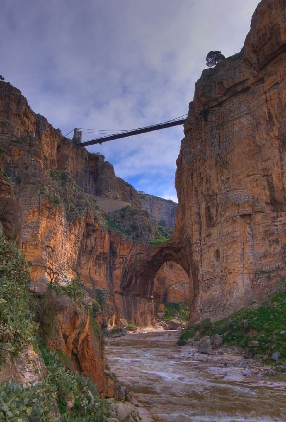
I’ve considered getting the Nool DEM tool but I’m not sure it would even be possible to achieve these rock cliffs using that, I don’t know how it handles vertical cliffs, and as you can see there are even caves. Would this require basically doing a giant 3D model of the entire gorge? How about in MSFS 2024, any new features planned there that would make it more feasible? There are buildings and roads lining the sides as well.
Imagine doing a canyon run through this.