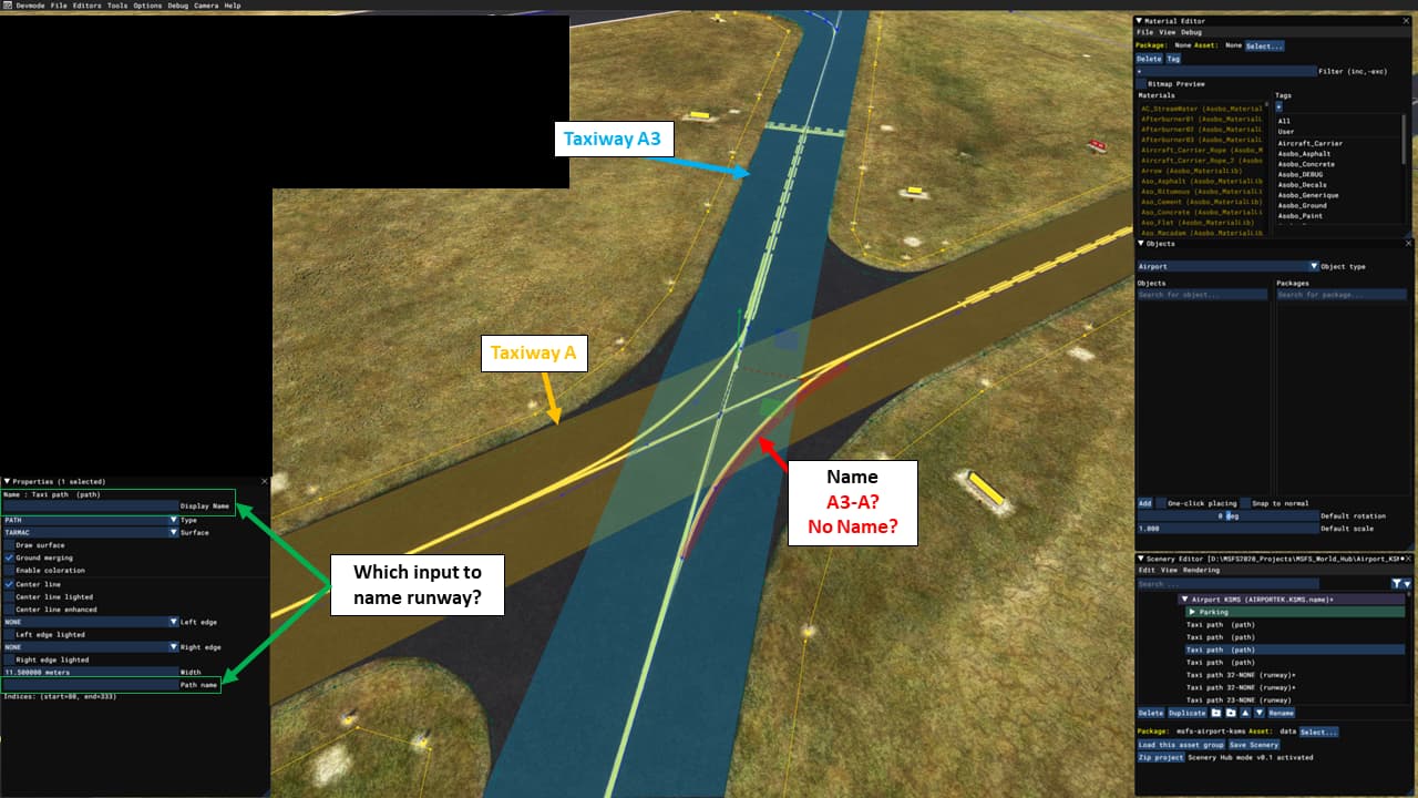
Do I designate the name of the taxiway through the “Display Name” or “Path Name” inputs to match the signs? (green on graphic)
==> The name of the taxiway should be designated through the “Path Name”.
==> Display name is for the name into the scenery editor window
Do I name the taxiway points or lines?
==> The taxiway lines (taxiway path), like your screen, green on graphic
For merging taxiways, do I name the merge lines with both taxiway names, or just leave blank? (red on graphic)
==> A3 or A, it doesn’t matter. As long as the editing logic is preserved. In the example, both curves must have the same name.
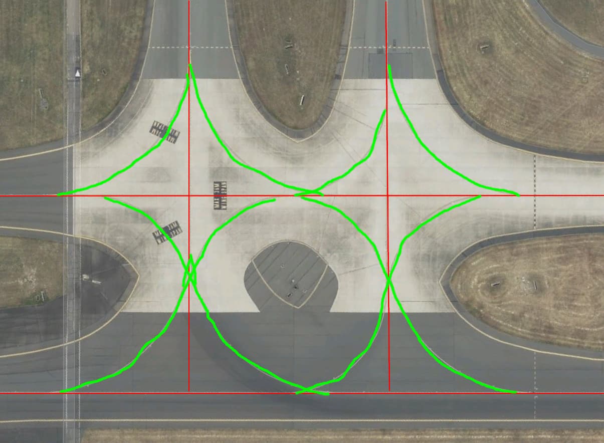
==> For complex areas, you can simplify the taxiway path (by a cross for example) and do the curves using painted lines, example below at Sydney (red = taxiway path, green = painted lines). Our system automatically connects a painted line to a taxiway path when they overlap + auto-generates curves for the entire AI part (trafic).
This is a phenomenal explanation! I’ve never really worked with taxiway names prior to WorldHub, so this is a good learning point.
I also ended up downloading an already approved project to see the breakout with a similar taxiway layout, and tried to reflect the naming convention/selection to match my submission. I’m pretty sure I followed this exact format.
This will be a great resource for others who might have the same issue. Thank you for the help.