Yeah. I would post the XML, but I don’t know what the rules are for this closed alpha.
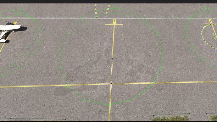
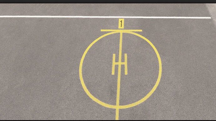
It would be an ugly “1” and it wouldn’t look like the other ones, which are black on yellow.
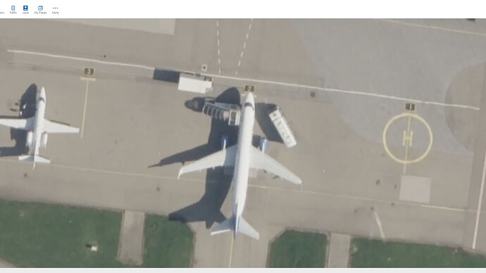
I could also lose the helipad, but I’m not really keen on that, either.
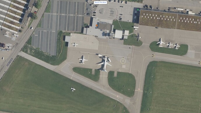
You have a point there. I could do that, but it would mean that no traffic could access part of the taxiway. I would also consider it a hack, effectively removing a taxiway in order to get it approved.
Off the top of my head, I know one other one. Also, I already did LECO airport, which would be rejected if I submitted it for having a helipad blocking a taxiway.
These two airports represent three weeks’ worth of work.
These are my notes for LSZR. It’s a lot:
Expand
Airport:
- Changed airport polygon size from S to M
- Added windsock for runway 10 at 47.485326, 9.553106
- Added windsock for helipad at 47.487262, 9.562404
- Created CarParking near new parking spaces, PARKING-16-NONE and PARKING-17-NONE, and connected one of the roads to taxiway M (47.487451, 9.556791)
- Fixed many grass aprons covering items in the ground so that they didn’t stand out as much
Runway 10-28:
- Changed width from 28.451054 m to 30 m
- Runway 10: Added approach lighting and removed REILs
- Runway 10: Adjusted PAPIs so they fit better on aerial
- Runway 28: Changed PAPI spacing from 6.5 m to 6 m and adjusted so it better fit on aerial (see note #3)
- Added circle and lines to center of runway
Runway 10L-28R:
- Fixed taxiways to 10L and 10R so that they went over the hold short lines in grass
- Drew hold short lines in grass
- Pulled back start positions
Taxiways:
- Made all taxiway signs smaller and the same size (that addresses this comment: St. Gallen Altenrhein (LSZR): Double taxi signs at handcrafted airport (after WU6 + hotfix) - #15 by HXArdito - Resolved - Microsoft Flight Simulator Forums )
- Corrected all taxiway signs at the airport so that they are real-world accurate. These taxiway signs are now more accurate than the bespoke LSZR provided in World Update 6.
- Removed centerline lighting from all taxiways (see https://youtu.be/jmDw9H_Uu4E – there is no centerline lighting)
- Added TaxiwayPaths near hangars A1-A3 (vicinity of 47.487527, 9.560880) and C1-C5 (vicinity of 47.486809, 9.563942)
- Fixed the PaintedLines at 47.486563, 9.552876 and 47.484682, 9.570766, as even though they were of type “marked”, it was too small to produce a runway marking on the ground
- Changed PaintedLines at 47.486932, 9.551691; 47.486933, 9.552491; 47.487213, 9.553220; 47.487483, 9.553573; 47.487339, 9.554933; and more to be SLIM_RED and surrounded them with white (see three of these white-red-white lines: https://youtu.be/UIF6fJoPw7o?t=483 )
- Added the three “MAX SPAN” boxes to the taxiways (see note #11)
- Shortened PaintedLine at 47.487196, 9.550746 and added a TaxiwayPath
Ramp:
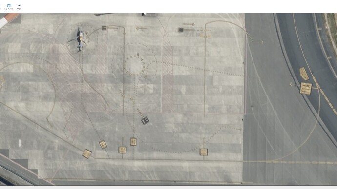
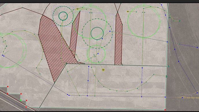
- Added helipad on top of PARKING-1-NONE (and also fixed up the line drawn there to make it a better circle) (see note #5)
- Altered PARKING-2-NONE and PARKING-3-NONE so they are approached from other direction and increased PARKING-2’s radius from 11 m to 15 m (see note #6)
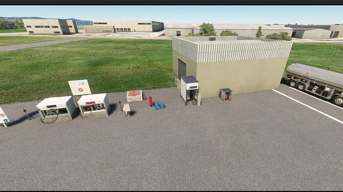
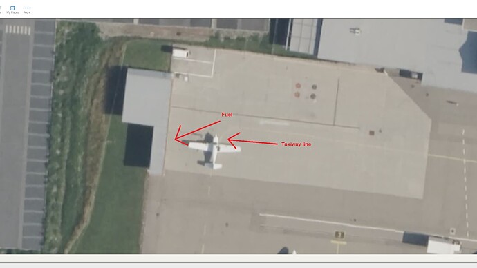
- Removed existing fuel parking and created a new one at 47.487562, 9.551774, near where the fuel really is ( see https://youtu.be/dZCj9nUzJiA?t=536 and note #9)
- Moved PARKING-10-NONE, -12, and -14 so that they were next to each other, made them all 6 m, and renamed them PARKING-13-NONE, -14, and -15
- Created PARKING-16-NONE and PARKING-17-NONE
- Added four parking spots (PARKING-18-NONE through -21-NONE) next to grass runway (vicinity of 47.485691, 9.567551, see note #8)
- Extended taxi path from PARKING-13-NONE, -14, -15 to taxiway M
- Changed taxiway N at 47.487239, 9.554283 from 25 m to 24 m, taxiway N at 47.487113, 9.555593 from 25 m to 18 m, and taxiway M to 14 m per the “MAX SPAN” signs posted on the ground
- Changed PaintedLines at 47.487069, 9.551163 and 47.487870, 9.556505 from WIDE_RED to DEFAULT
Notes:
- As far as I can tell, Bing’s aerial is up to date for this airport. However, I did notice that a particular spot in Bing did not have the precise same coordinates as its aerial counterpart. In other words, the aerial in MSFS and the aerial in Bing do not completely line up. So, the choice was either to redo the entire airport using Bing coordinates, or just place things according to the aerial and forget Bing coordinates. I chose to do the latter.
- Some of the airport is shifted over by maybe a meter or so. I don’t feel like changing up the whole airport, so I left it as is and moved some items a little bit so they fit what was on the ground.
- There is no SDK option for the actual approach lighting on runway 10. So I copied what the bespoke LSZR used, which looks to be RAIL. However, unlike their version, I did not put any lights on the displaced threshold, and I put the correct number of lights (6) past the threshold (the bespoke LSZR uses 5, which is wrong…you can count them in the Bing aerial).
- The PAPI spacing for runway 28 is less than 6 m, but you can only adjust it down to 6 m.
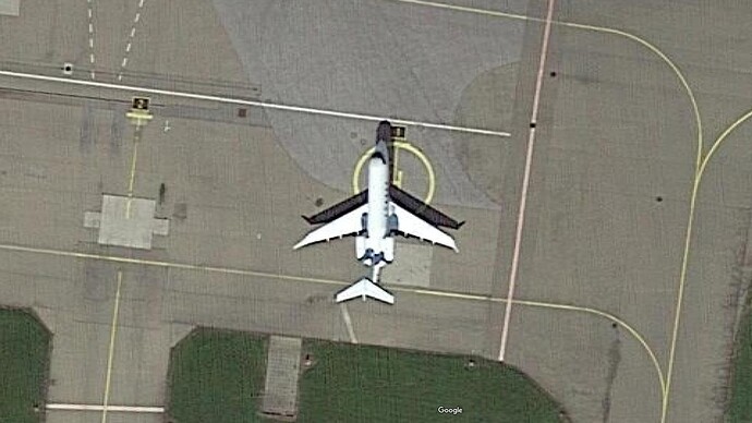
- I did not delete PARKING-1-NONE because in this video, you can clearly see a jet parked on top of the helipad: https://youtu.be/cz52iBx7R0M?t=115
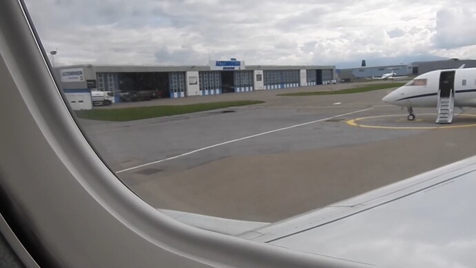
- It does not look like large aircraft should park in PARKING-2-NONE, however if you look at Bing (47.487155, 9.552537), you will see an aircraft with a 25 m wingspan parked there. In this video, you can see the tail end of a large jet in that parking space: https://youtu.be/dZCj9nUzJiA?t=500 . I made the spot 22 m wide to give other aircraft a chance to park in spots 1 and 3.
- The numbered spaces 3, 2, and 1 are not even with the white line just above it. That is deliberate. If you look at the Bing aerial (47.487180, 9.552542), you will see that they do not line up there, either.
- I would love for grass parking spaces to be a lot larger, as I can see two gliders sitting on the spots in the Bing aerial. However, I’m afraid that if I make wide radii for the spots in order to accommodate gliders, the sim is going to put A320s in those spots, which would not be good.
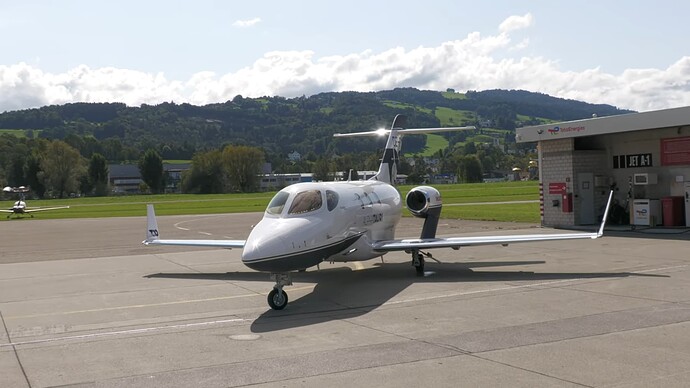
- The fuel pumps are actually underneath the overhang of the building: https://youtu.be/AvME5HeZ8BU?t=124 Ideally, I would like to push the parking space into the building, but I assume that that is not allowed.
- The sign at 47.486337, 9.553621 (d< N|< A >) is real. It’s non-standard, but that’s what’s actually at the airfield: https://youtu.be/9pc749i23Ik?t=2005
- Only the MAX SPAN boxes were added, not the actual text, as that is not supported right now in the World Hub SDK.
Pictures used for reference:
https://flighttraining.ch/wp-content/uploads/2016/11/lszr_bodenkarte_detail.png (Contrary to the URL, the chart is from June 2022)
Videos used for reference:
https://www.youtube.com/watch?v=UIF6fJoPw7o&t=333s (Dec 15, 2023 – Runway 20, taxiway A, S, N)
https://www.youtube.com/watch?v=azZabBSisKw (Dec 12, 2023 – Taxiway N; play it in 0.25 speed)
https://www.youtube.com/watch?v=9pc749i23Ik&t=1884s (Sep 5, 2023 – Taxiway N, A, S)
https://www.youtube.com/watch?v=aEPpCORRaPY&&t=117s (Nov 15, 2021 – Used only for taxiway sign pointing to taxiway A (“<A”))
https://www.youtube.com/watch?v=oLOdsxlsPjY (May 28, 2020 – Helicopter taking off near helipad at 47.487152, 9.562229)
https://www.youtube.com/watch?v=jmDw9H_Uu4E (Feb 13, 2018 – Used only to determine that there are no center lights on the taxiways)
https://www.youtube.com/watch?v=LXNdbXnuVgg (May 3, 2016 – White, red, white lines)
https://www.youtube.com/shorts/0Oo6c_kKcW0 (Jan 3, 2016 – Used only for approach lighting)
https://www.youtube.com/watch?v=hRScP-E7YTs (Nov 15, 2015 – Used only for approach lighting)
In some ways, this is more accurate than the bespoke LSZR, which is why I did it. (Same thing for LECO.)
I take a lot of pride in the airports that I do, and it feels like any changes I would take away from the realism.
