The Airstrip HDHA (Dhahab Airport) in Saudi Arabia is permanently closed due to construction work for “The Line”.
So far I removed the Airstrip, SimObjects etc. and submitted the “empty” file.
Won´t let me submit the file without the Airport designator.
What needs to be done to remove it from MSFS Worldmap?
Hi
It’s a process we have to do internaly
Thx for the report
This is a topic I brought up on the main forums (much to the horror of many). Would you like us to add examples in this thread or submit them in other ways?
Two examples I came across in the UK are:
EGEJ - built over by Amazon warehouse Bing Kaarten - Routebeschrijvingen, reizen plannen, verkeerscamera's en meer
EGAX - dug up for clay mining or similar by the looks of it Bing Kaarten - Routebeschrijvingen, reizen plannen, verkeerscamera's en meer
Then there are airfields which are closed, but the runways remain. Could they be submitted to World Hub with the “closed” flag set to “true”? SDK describes it as:
closed Stop the airport from being accessible or interactive in any interface such as the world map, the instruments or the ATC system. The airport is only going to be rendered in the simulator…
Thanks for the clarifications.
(Edit: Not sure why the Bing Maps links/preview appear in Dutch in my post; all showing in English on my side!)
1 Like
Can add to this (until a more effective means is found)
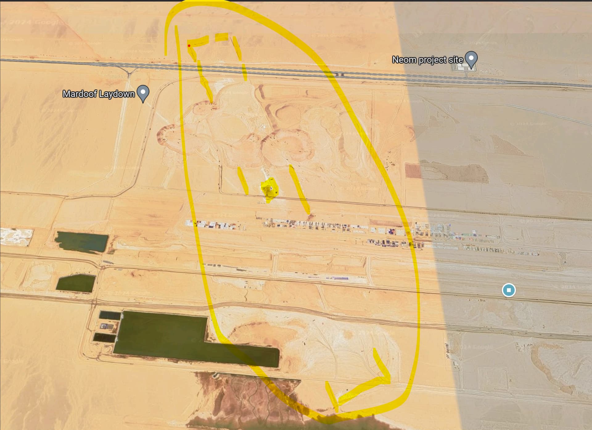
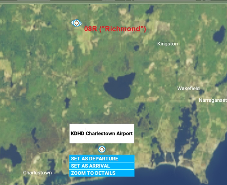
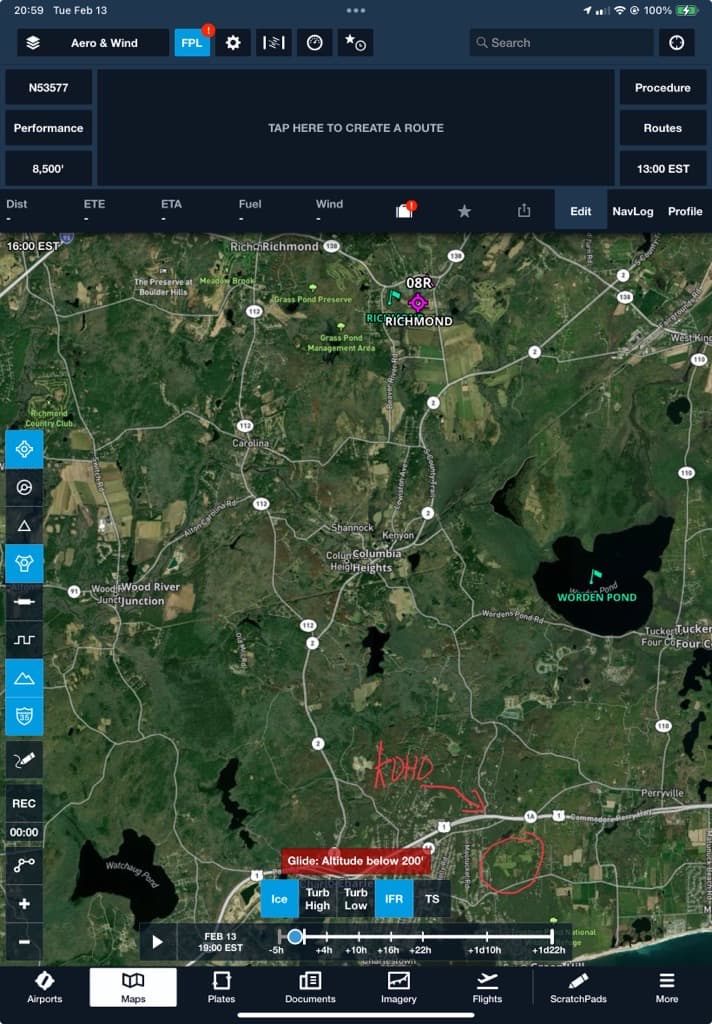
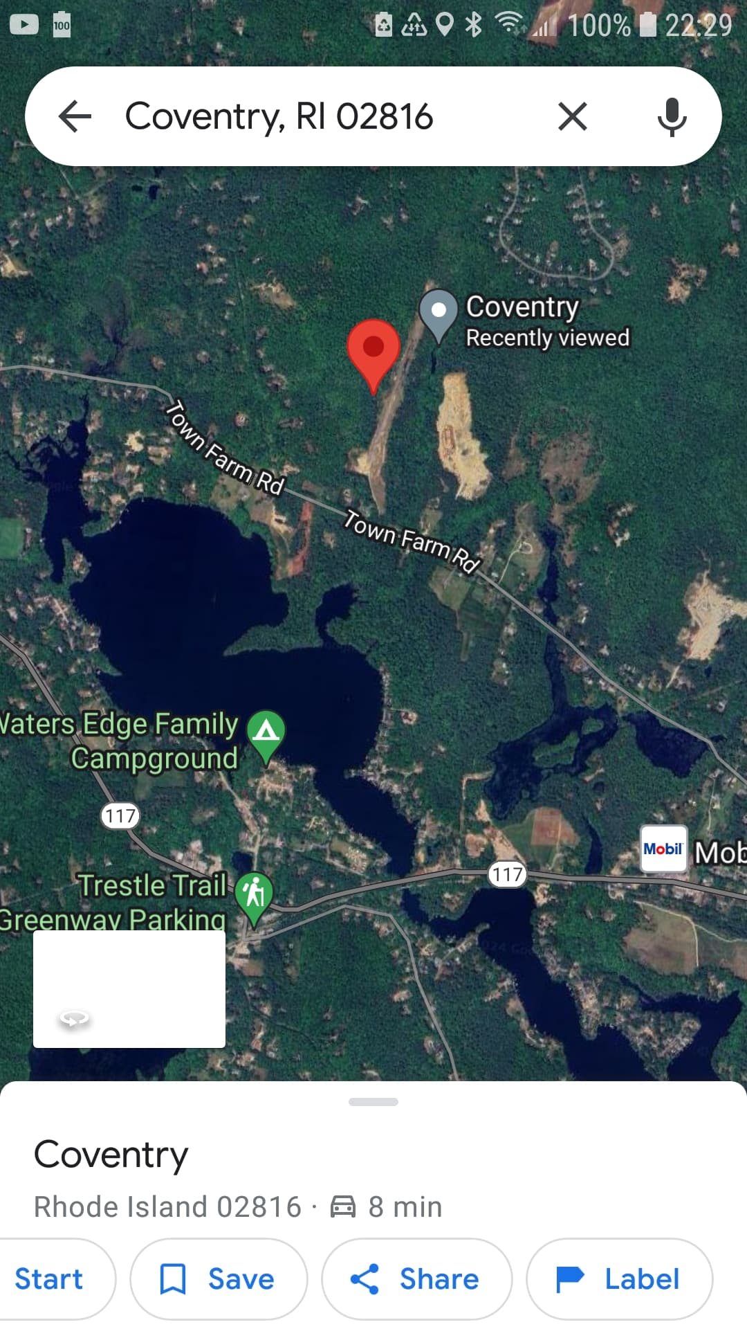
In Rhode Island, A private strip @ (41.388228°, -71.593303°) is being assumed as an airport (“KDHD”). This strip is not even identified as a “Status Unknown” on the New York Sectional.
KDHD never existed
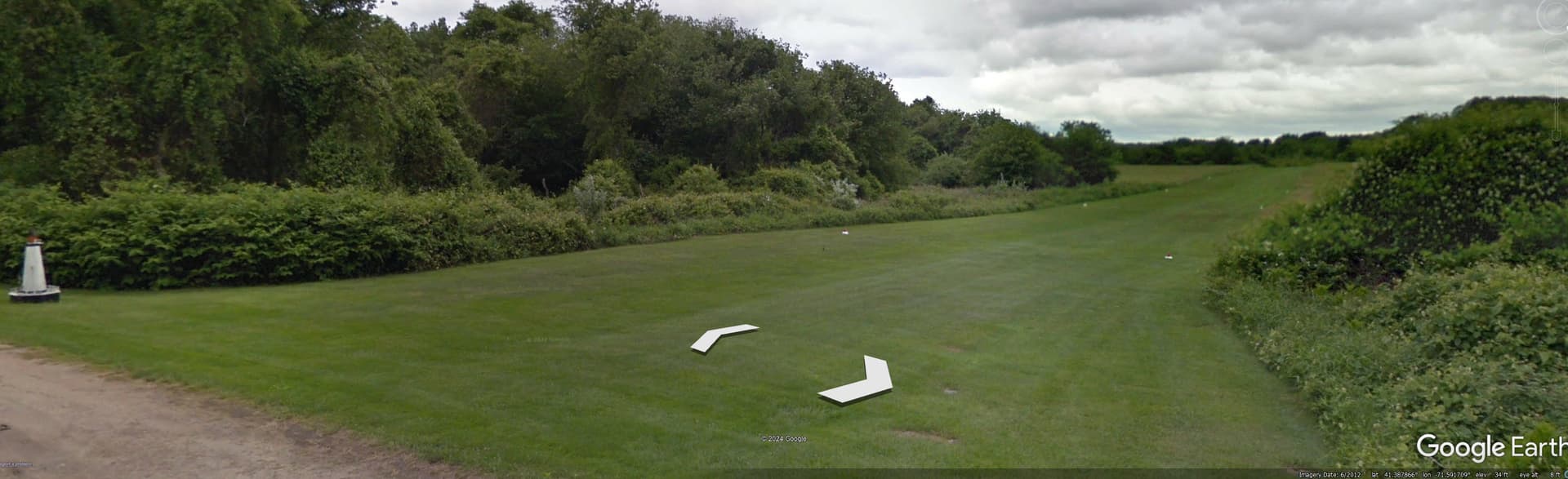
Can you verify something? Look at the field just to the northeast of the field you circled. There is a grass runway and a hangar there and it even looks like it’s lighted. Verified on Street View. Is that the airport that depicted in the sim?
Either way, it is uncharted and unlisted. However, I implore the powers that be to change away from using ICAO-looking IDs to these kinds of airports.
One in the same (I doubt an air strip like this would have FAA/OACI K ident)
edit, ended up sending an email to the FAA about if something like would be marked on the sectional as an “UNKNOWN”, considering the nature of the strip
1 Like
Just for perspective, there are about 13,000 registered airports in the US. Of those, only about 2,500 have an ICAO K or PA/PH identifier. The other 10,500 do not, instead using a three or four digit alphanumeric code. If you add the 6,500 other facilities (heliports, seaplane bases, etc), only 67 of those have an ICAO K or PA/PH ID.
That said, not every registered airstrip is charted, in fact many registered, private strips have been removed from sectionals over the past few years. Beyond that, there are a lot of unregistered and uncharted strips, including the one we’re discussing. If the owner wants it registered, they have to fill out an FAA Form 7480-1. If they want it charted, they can apply for that separately.
This one is private, unregistered and the owner probably doesn’t want it charted. I’d be curious to hear what the FAA says, but I don’t think much will come of it.
But to the point, I don’t think Asobo (or their AI) should be in the habit of generating ICAO codes for these unregistered strips. They need to use something more generic.
1 Like
The FAA mentioned the same thing about the paperwork. I guess after seeing this unknown strip (~8 miles west of kpvd) having an unknown designation (
https://maps.app.goo.gl/BkFR3DBKrEHYZg1d8)
seeing this little guy would be a shoe in for unknown status (but it’s the FAA we’re talking about

)