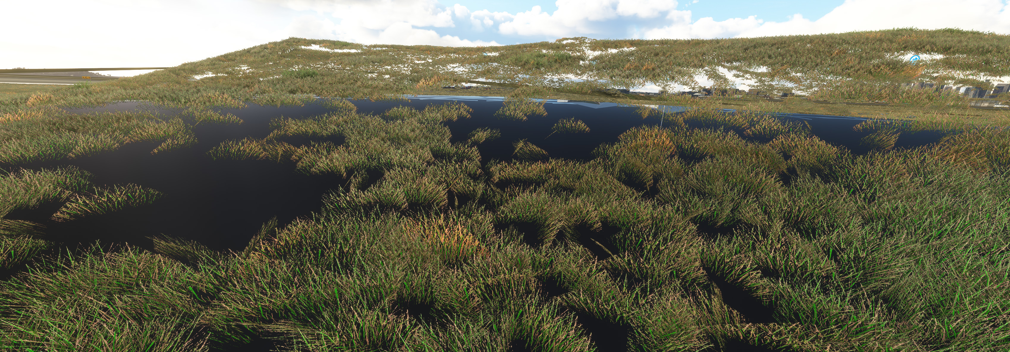
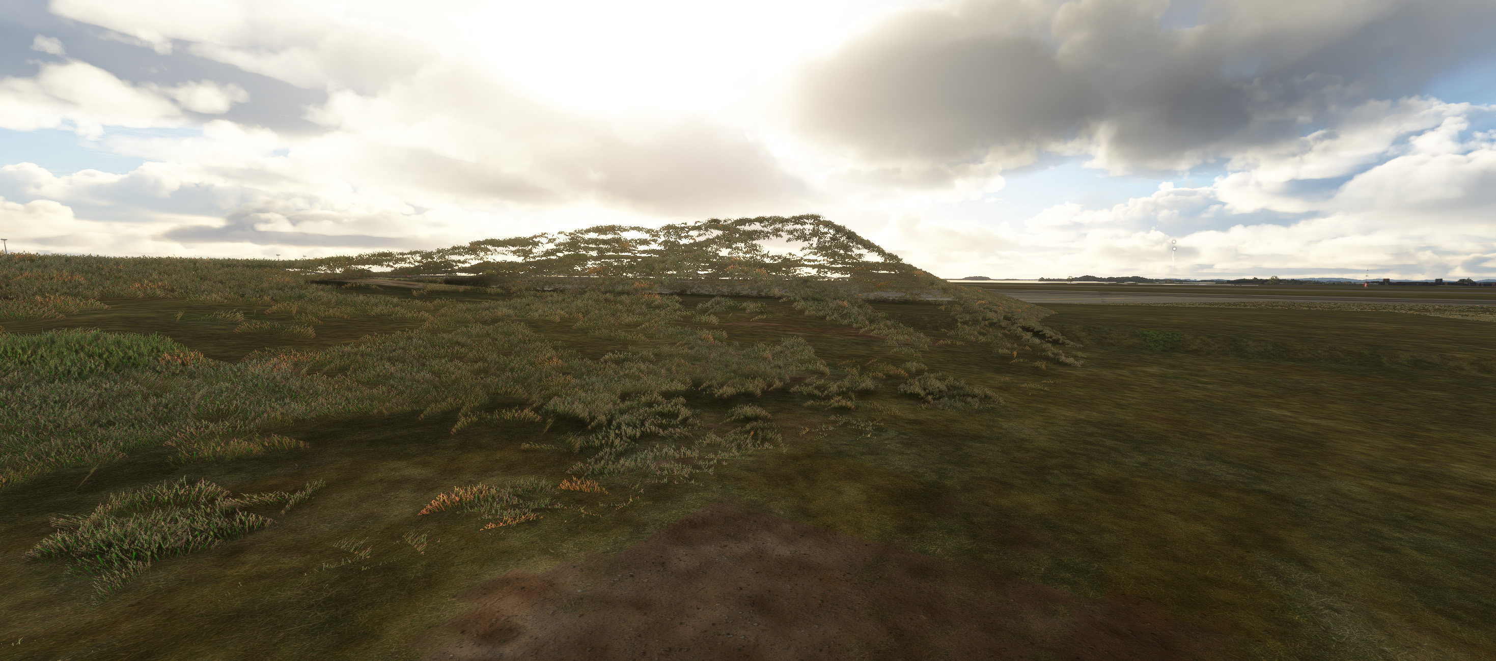
Terraforming on areas with TIN is very unpredictable. Be it with polygons or
heightmaps. Earlier builds had similar issues on non TIN areas; now fixed. I’m
not sure if the remaining TIN area Terraforming is bugged or I’m not using it
right. I’ve had no problems getting reasonably precise terraforming results on
previous projects in non TIN areas. Attached a couple of shots. The floating
grass is actually the least of the problem. WIth either polygons or
heightmaps, the terrain will almost always give undesirable results.
Secondary, can I plead for Asobo to allow CGL on TIN areas in the future?
Often the stock aerials are out of date and we use our CGLs to help grass
generation(sometimes). I’ve been forced to use a projected mesh aerial which
doesn’t work with your lovely Aprons and their faded edges. That’s another
great feature. Aprons on top of pro meshes are currently not working, probably
by design, but it would be nice to have the option. Cheers. George Flytampa
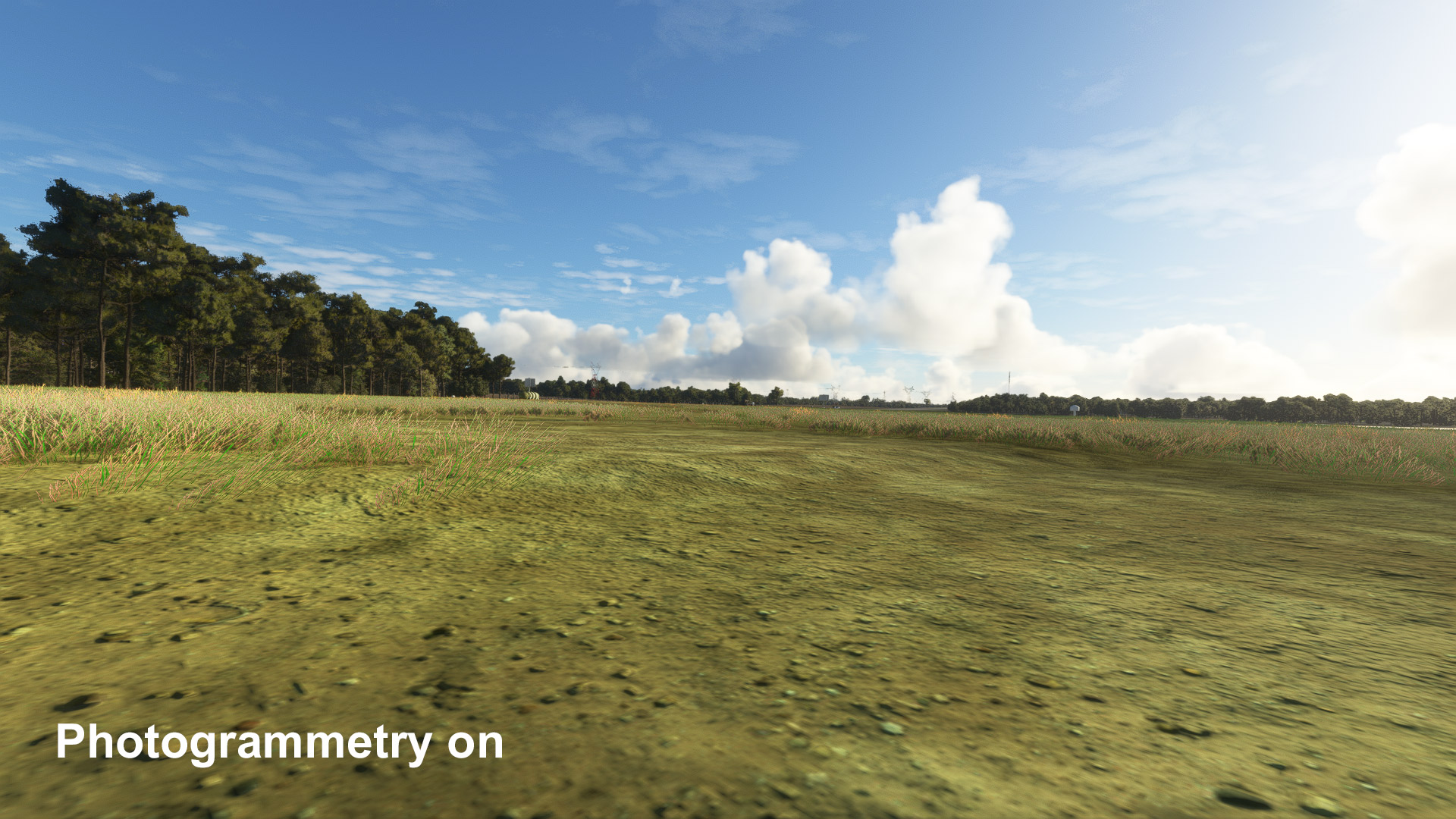
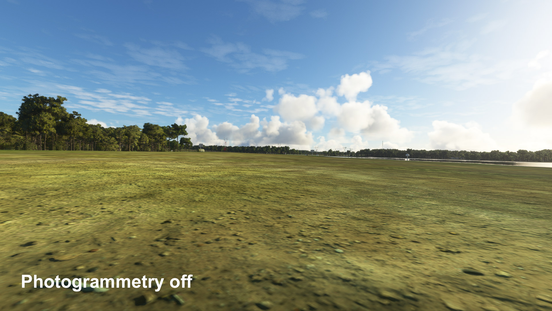
Bumping a bit of a dated topic here, but I’m still seeing a similar issue at
my airport. I’m not sure if this has just never been addressed or if it’s just
reappeared with SU12. This is my only airport in a TIN area, so I don’t have
to work with that data set too much. Does TIN have a certain priority level
(like runways) that needs to be exceeded by an overlaying heightmap? With
Photogrammetry turned off and using the original terraforming system, my
elevations work as expected, however as soon as PG gets turned on, the
elevations are calculated differently and steps and dips (floating grass
described above) begin to appear across my runways, rendering it pretty much
useless. I have tried to correct the steps with another terraforming
rectangle, but it doesn’t seem to have any affect, no matter what I make the
priority. I did change all of my terraforming rectangles to have a base
priority of 6, and bumping that up seems to make a noticeable difference, but
it is clearly still not fully overriding the PG elevation data (Even with a
TIN exclude).
1 Like
Bumping this, I’m having similar issues in Stow MA working on the Collings Foundation field (not represented in the sim, but real). PG overriding terraforming and grass floating, etc…
Not to mention polygon TIN exclusions act different in regular mode vs developer mode (more gets excluded in regular mode), so it’s really hard to get right.
Is there any way to get photogrammetry to sit on top of Terraforming polygons and/or rectangles?
I can’t wait for 2024 when that photogrammetric boxy, ugly foliage goes away… I hope!!!