Why are new aerials often offset from old ones, causing work done in the World Hub to be incorrect? Is it tolerances that shift the aprons, lights and other objects, or math errors, or coordinates specified in the aerials themselves or what? Can an “Alignment” tool be provided in the World Hub that will allow the World Hub work to be repositioned over the new aerial relatively easily?
About twenty-five years ago, I worked for a company that did GIS work. Although I didnt heavily touch the GIS stuff, I picked up some of it, though I’m by no means an expert. Aerials can be taken from different altitudes using different equipment and different lenses. GPS is accurate within certain tolerances, contributing to minor errors. Also, when stitching aerial photos together, the system uses identifiable things on the ground to create seamless stitches, and between all of this, you can get variation. These are the things I know about.
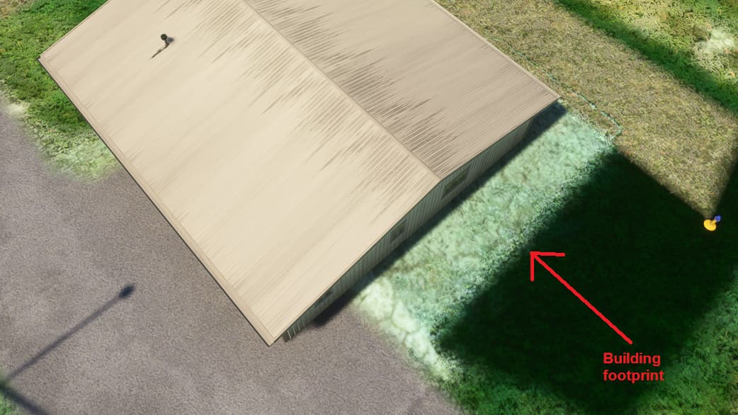
Unfortunately, in addition to the aerials being off, we also see things that are not even on their aerials. I don’t know why that is. We might see some OpenStreetMap buildings…
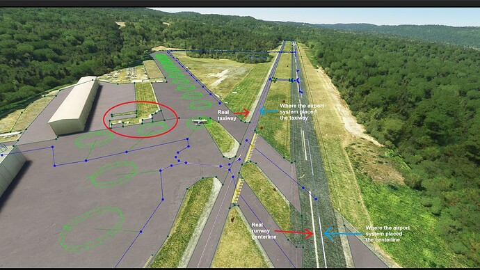
but I don’t understand why even a runway and taxiway would be off:
I’ve seen this, too. If we had the easy ability to select several airport objects at a time we could reposition them fairly quickly. As it is, however, you can’t do this without looking at many areas in a detail view, renaming them and/or group them, then select what needs to be repositioned and move them. It just is more difficult than it needs to be.
As for OSM builings being off, I wonder if they are placed using coordinates from the OSM data which can be off due to methods used by the public to report those buildings to the OSM database(?), as well as other reasons. These coordinates can be considerably different than the placed in-sim aerial. Also, we have the tolerances of the OSM map plus the in-sim aerial, resulting in greater potential error than just one map alone.
You actually can. I’m not in front of MSFS right now (and I won’t be for two weeks…sigh, going to miss most of the window to finish edits), but I think you press Shift (I think) and drag a block around whatever you want to select. Unfortunately, the selection box will not generate if you do this when one or more items are currently highlighted.
More “unfortunately” – I’ve found that when I do this method, the not everything is off by the same amount. So, I could try and drag everything to be closer to the aerial and find that it doesn’t align properly.
I haven’t done experiments to see if they are the OSM buildings that are off (one could experiment by putting an exclusion polygon around one of them and finding out what bucket they fall into). But OSM would make sense, as their coordinate system is going to be slightly off of Bing’s. Even if you were to take a coordinate off of Google and put it in Bing, it’s typically not going to be the same exact point.
If the buildings that were off were auto-detected buildings, that would be really bad.

