Could the airport generation system be adjusted so that it places objects perfectly on aerials?

This piece of feedback is not the SDK team’s fault. But for a World Hub developer who often uses lat/long coordinates to adjust aprons and put down objects, it is a pain point, and I’m hoping that there is a long-term solution, here.

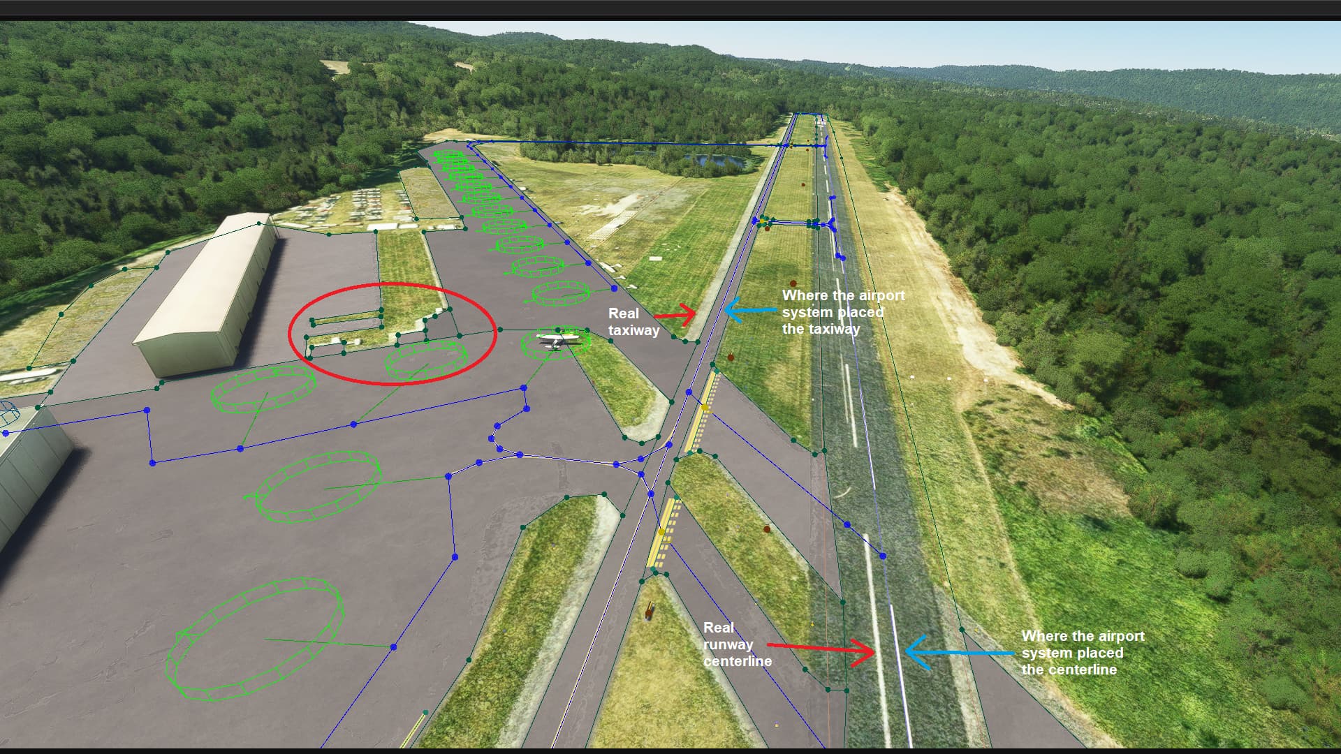
I’m starting a new World Hub airport. It’s a very simple uncontrolled airport in the middle of nowhere. Should be very easy to spruce up. However, what started as a quick win becomes a nontrivial project when the system that generates airport doesn’t match their aerials. Please see the following screenshot. I made the apron and runway transparent so you can see that the runway centerline doesn’t match up. The taxiway doesn’t match up. I put a circle around another area where the apron doesn’t match up.

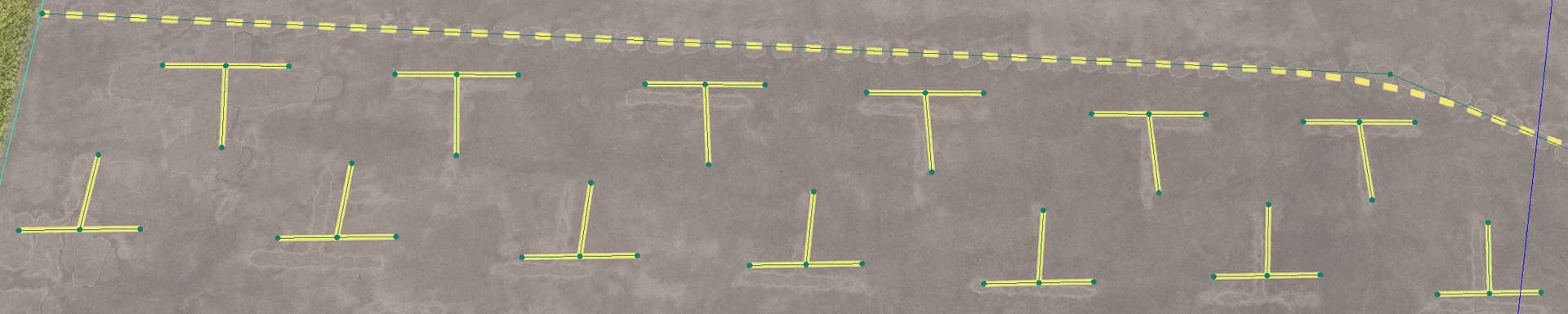
I’ve done 13 airports, and is the fourth time I’ve come across this issue. So, I’m seeing this at approximately a 25% rate. I’ve already used this next example twice before from another airport:

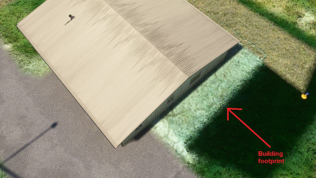
You see how the building is not actually on the building footprint? If I were to place an object that far off in a World Hub submission, moderators should be rejecting it (in my opinion). It should not be acceptable. But, the AI system is doing it.

I cannot leave an airport like this when I see this. And when the airport looks like this, I cannot do anything involving coordinates, because coordinates will not work. Thank goodness KBWI, an airport I did entirely on coordinates, was not one of those cases, or I simply would not have been able to do it.

It’s exhausting and demoralizing when you see the system making the same mistakes over and over again at different airports. The bread and butter I see for the World Hub is to be able to go in and place windsocks in the right place (because I get that the system has trouble placing them when they’re hard for a human to see) and to get the taxiway names and signs correct because it’s difficult to match aerodrome charts to reality (I’ll post about double-sided taxiway signs in a future post…that’s another pain point for me), and to correct other minor mistakes. I don’t want to be correcting something that should be in the wheelhouse of the AI-based system that generates these airports.

It’s clear to me that the system is correctly finding runways and finding buildings and finding taxiways. If it’s finding them, shouldn’t it be putting objects on them right where it found them? The AI system can regenerate the world in a few dozen hours. Were a team of humans to do that to each airport in the database, it would probably take a century to do it.

I realize that this “idea” is peripheral to the World Hub and SDK teams, so maybe it’s out of scope for World Hub feedback. But I had to get this out there, because this problem is going to come up again and again.

I’ve experienced the same misalignment you have and was asked one time to cover the exposed flat areas showing the building positions with concrete aprons. In a previous post, I asked how accurate placement is “in-sim,” but got no response. I have read that Bing Maps is plus or minus 1.5 meters, which would seem to be a wide enough “error” to cause such apparent mis-alignment. So it could be we’ll just have to live with this issue, although I agree it would seem the AI might be able to compensate.

In one of my submissions, I noticed that Bing Maps coordinates do not always match in-sim coordinates and I was ready to give up on the idea of using coordinates to place nodes (see post), so the only way to get things to match is to move them to the position shown in the aerial. I’ve since had better experiences using coordinates. But the “mis-alignment” issue may be a complicated one for Asobo/Microsoft to tackle.

Oh yeah, that is a very good concern you raised in that other thread about what happens when another aerial gets laid down…if it’s not as accurately aligned, what happens? Or, what if you download a World Hub airport, see that it’s misaligned, and decide that it’s too much trouble to align everything, so you work with the misaligned aerial, and then a different aerial shows up and it’s more accurately aligned? Does the system throw your changes away because they no longer line up? That’s a scary proposition.

I still haven’t heard back from anyone official on my questions about what happens when new aerials get overlaid. It’s getting me nervous, and I think I’m going to stop work after a few more airports until after the MSFS 2024 launch, as this uncertainty is not good, and I’ve spent way too much time on this to have it all blown away in a few months.

I haven’t heard anything about Bing’s accuracy, but I do know that there can be discrepancies between Bing and Google Maps from time to time. (And that is not to imply that it’s necessarily Bing that’s off. But it does show that there is variability.)

I can say that regarding Bing vs. MSFS, the taxiways in the above airport screenshot are 8 m wide, and they appear to be off by about half a taxiway width, or roughly 4 m. That’s about the width of a highway lane.

1 Like

Yes, you’ve asked some good questions that beg answers. I hope we learn something soon.

taxiways in the above airport screenshot are 8 m wide, and they appear to be off by about half a taxiway width, or roughly 4 m

Interesting, that’s even greater than ± 1.5 meters. So it would be good to learn more about these topics!

1 Like

Here’s another example. These are T’s drawn in PaintedLines by the AI system. It doesn’t make sense to me that the system knows there are T’s there and draws them badly.

They don’t look good:

Of course, the purpose of this thread is to ask that the AI system be tweaked to create less work for World Hub developers. So really, what I should be asking for is for the system to generate aircraft parking over these. Otherwise, I, or someone else in my position, am going to see these and spend a couple hours putting parking spots in there.